Ireland, Europe‘s “emerald”, is a popular tourist destination today known for its picturesque rivers in Ireland. Numerous rivers enter several waters, including the Irish Sea, Celtic Sea, and Atlantic Ocean, in Ireland. Ireland’s longest rivers each have their unique allure.
A country’s natural riches and attractiveness are greatly influenced by its rivers. Ireland is no different, where the country’s various rivers enhance the environment and meet locals’ needs. From the powerful River Shannon to the River Erne, we examine the rivers in Ireland in this article.
These rivers are essential components of Ireland’s natural heritage because they each have a distinctive history, geography, and cultural value.
We will look at their lengths, catchment regions, water quality, tributaries, and ecological significance to give you a better understanding of how important these majestic rivers are to the Irish people and the environment.
List of rivers in Ireland
- River Shannon
- River Barrow
- River Suir
- Munster Blackwater
- River Bann
- River Nore
- River Suck
- River Liffey
- River Erne
River Shannon
Length: 360.5 km
The River Shannon, which measures 360.5 kilometers (224 miles), is the longest river in the British Isles (Irish: Abhainn na Sionainne, a tSionainn, a tSionna). One-fifth of the island’s entire area—16,865 km2 (6,512 sq mi)—the Shannon River Basin—is drained by it.
Ireland’s west, which is mostly the Connacht province, is divided from the country’s east and south, which are Leinster and the majority of Munster. (County Clare is an exception; it is located west of the Shannon but is part of the province of Munster.)
The river acts as a significant physical barrier between east and west with just under thirty-five crossing points between Limerick City in the south and the town of Dowra in the north.
The Shannon River separates Ireland’s west (primarily the province of Connacht) from the east and south (Leinster and most of Munster). (County Clare is an exception; it is located west of the Shannon but is part of the province of Munster.)
The river acts as a significant physical barrier between east and west with just under thirty-five crossing points between Limerick City in the south and the town of Dowra in the north.
The Shannon has long been considered a prominent river, and it appears on maps for the first time by the Graeco-Egyptian geographer Ptolemy (c. 100 – c. 170 AD).
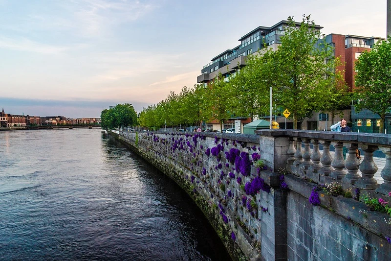
From the Shannon Pot in County Cavan, this iconic example of rivers in Ireland flows south before turning west and entering the Atlantic Ocean through the 102.1 km (63.4 mi) long Shannon Estuary.
The city of Limerick is situated where the river meets the seawater of the estuary. East of Limerick, up to the base of the Ardnacrusha dam, the Shannon is tide-dependent. It is regarded as one of Ireland’s longest rivers.
River Barrow
Length: 192 km
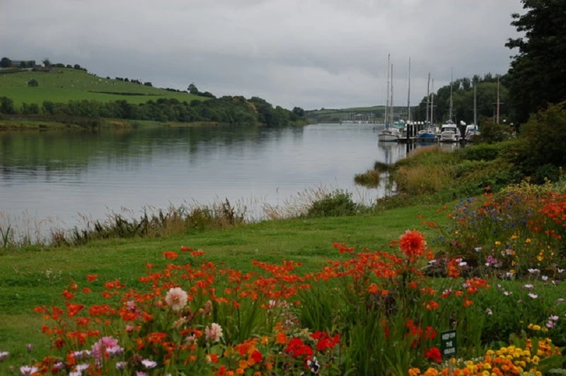
The River Barrow (Irish: An Bhear) is located in Ireland and stands as a testament to the majestic rivers in Ireland. It is one of The Three Sisters, the other two being the Rivers Suir and Nore. With a length of 192 kilometres (120 miles), the Barrow is the longest of the three rivers and, after the Shannon, is the second-longest river in Ireland.
Before the River Nore meets the River Barrow a little more than 20 km before its mouth, the River Barrow has a catchment area of 3,067 km2.
The river’s long-term average flow rate before joining River Nore was 37.4 cubic metres per second. Its catchment area is nearly 5,500 km2, and when it joins the River Suir, it discharges around 80 m3/s.
The River Barrow originates at Glenbarrow in the County of Laois Slieve Bloom Mountains.
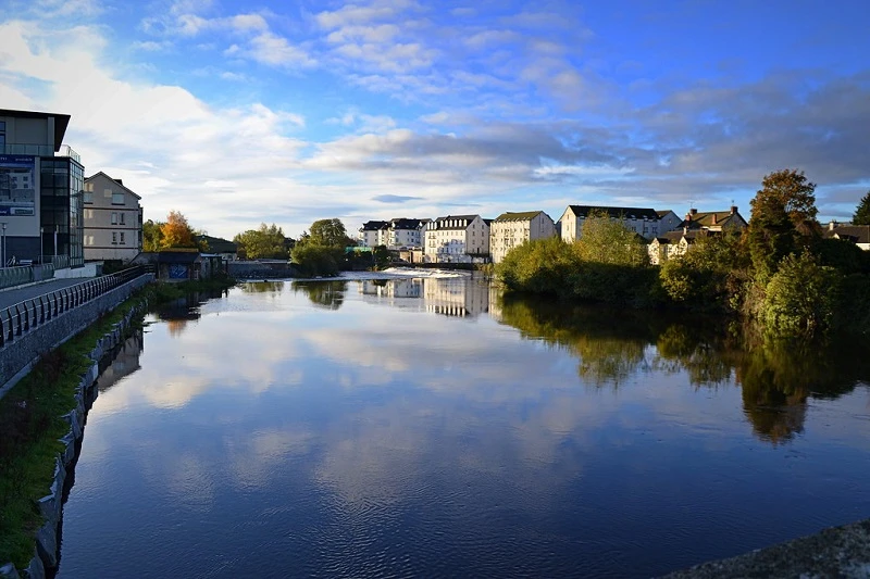
Along the River Barrow’s path to the sea beyond Waterford, it passes through Portarlington, Monasterevin, Athy, Carlow/Graiguecullen, Muine Bheag (Bagenalstown), Goresbridge, Graiguenamanagh, and New Ross, among other towns.
Between the counties of Carlow and Wexford on the left bank and Kilkenny and Waterford on the right, the river acts as a natural border. It is regarded as one of Ireland’s longest rivers.
River Suir
Length: 185 km
The River Suir, one of the notable rivers in Ireland, travels 185 kilometers (115 mi) through Waterford before emptying into the Atlantic Ocean. The Suir has a 3,610 km2 catchment area.
Its long-term average flow rate is 76.9 cubic metres per second (m3/s), which is slightly less than the Barrow’s flow when it reaches the Suir 20 km downstream (almost 80 m3/s) but nearly twice as much as either the River Barrow’s flow (37.4 m3/s) or the River Nore’s (42.9 m3/s) before the link.
The Irish name for the River Suir is Sir, and the modern English spelling with the u and I reversed is considered incorrect. Because of this, some people think the English spelling of the word should be Siur, and this spelling is infrequently seen. It is regarded as one of Ireland’s longest rivers.
The Fairie Queene author Edmund Spenser (1552–1599) referred to the “gentle Shure” in his writings during the Elizabethan era while living in County Cork. This reference is most likely the most accurate spelling and phonetically correct at the time.
In the early years of the twenty-first century, ruins of a sizable Viking hamlet were found close to a river bend in Woodstown, just upstream from Waterford.
Munster Blackwater
Length: 169 km
The Blackwater, one of the renowned rivers in Ireland and also known as the Munster Blackwater (Irish: An Abhainn Mhór, which translates as “Big River”), flows through the counties of Kerry, Cork, and Waterford.
It originates in the Mullaghareirk Mountains in County Kerry and flows into County Cork from the east, passing through Mallow and Fermoy.
Following Lismore in County Waterford, it flows past Cappoquin before abruptly turning south and eventually emptying into the Celtic Sea at Youghal Harbor.
The total length of the Blackwater is 169 kilometers (105 miles). 3,324 km2 make up the whole catchment area for the River Blackwater. Long-term average flow on the River Blackwater is 89.1 cubic metres per second (m3/s).
One of the best salmon-fishing rivers in the country is the Munster Blackwater. Despite the Irish government banning commercial salmon netting off its coast in November 2006, salmon populations have fallen in recent years, as they have in many Irish and British rivers.
The Blackwater Estuary was added to the Ramsar List of Wetlands of International Importance on June 11, 1996. Additionally, the area, which stretches from Youghal New Bridge to the peninsula of Ferry Point at the river’s outflow to the sea, is a Special Protection Area (SPA) under the European Union’s Birds Directive.
River Bann
Length: 129 km
The River Bann, standing out among the iconic rivers in Ireland, is one of Northern Ireland’s longest rivers, stretching 129 kilometres (80 miles) when the Upper and Lower Banns are united.
The River Bann is 159 kilometres (99 mi) long altogether, including its passage through the 30 km (19 mi) long Lough Neagh.
The River Bann is thought to be 90 kilometres long. The river stops in the middle to widen into the enormous Lough Neagh as it runs from the southeast corner of Northern Ireland to the northwest coast. 5,775 km2 make up the River Bann’s catchment area. The River Bann discharges water at a 92 m3/s average rate.
The salmon and eel fisheries of today are the most significant economic components of the River Bann. The “Bann split,” which divides the eastern and western parts of Northern Ireland, typically follows the river.
Towns, communities, and businesses west of the Bann are usually thought to have lower levels of government expenditure and investment than those in the east.
It is also seen as a religious, economic, and political division, with Ulster Protestants and unionists in the east and Greater Belfast acting as the region’s financial and industrial core to the west, and Catholics and Irish nationalists residing in the west. The Bann Valley is seen as being more rural and agricultural.
River Nore
Length: 140 km
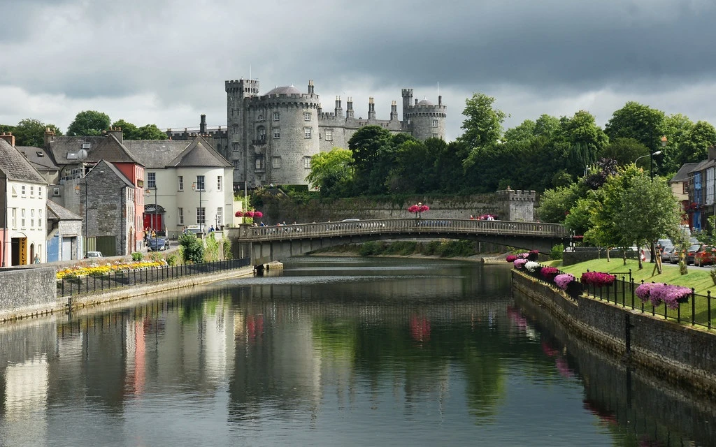
One of the standout rivers in Ireland, especially in the south-east, is the River Nore. Along with the River Suir and the River Barrow, it plays a significant role in the region’s hydrology.
The 2,530 square kilometres (977 square miles) of Leinster and Munster, which comprises portions of three counties (Tipperary, Laois, and Kilkenny), are drained by this 140 km (87 mi) long river.
Along with the River Suir and the River Barrow, it is one of the Three Sisters rivers.
Beginning in Devil’s Bit Mountain in County Tipperary, the river flows southeast before turning south till it meets the River Barrow at Ringwood and the Barrow railway bridge at Drumdowney in County Kilkenny, before emptying into the Celtic Sea at Waterford Harbour in County Waterford.
The long-term average flow rate of the River Nore is 42.9 cubic metres per second (m3/s).
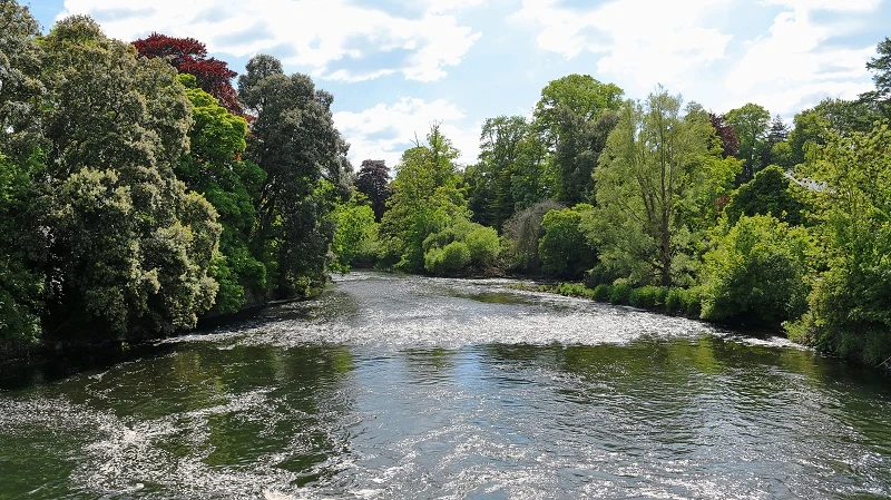
The River Nore has the sole known population of the critically endangered Nore freshwater pearl mussel, and most of its length has been classified as a Special Area of Conservation. The Nore rises on the eastern flanks of Devil’s Bit Mountain in the townland of Borrisnoe, County Tipperary.
Further south, particularly close to Inistioge, a town at the tidal limit, it creates a magnificent V-shaped river valley. Major tributaries of the Nore include the Dinan, the Breagagh in Kilkenny City, the King’s River, the Little Arrigle, and the Black Water.
River Suck
Length: 133 km
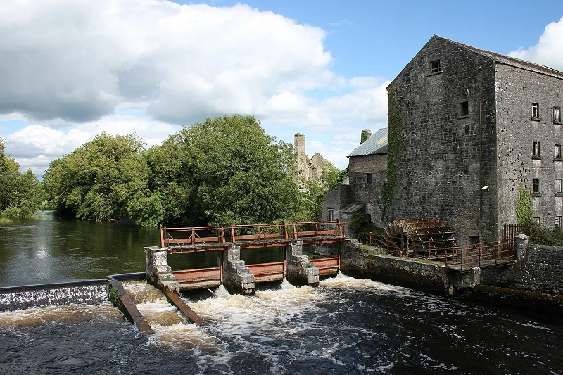
The River Suck (Irish: An tSuca [n tk]) is a 133-kilometer-long (82.5-mile) river in Ireland’s Shannon River Basin. It is the main tributary of the Shannon River. About a km south of Shannonbridge, it merges with the Shannon. The drainage area of the River Suck is 1,599 square kilometres (617 square miles).
The River Suck, winding its way as one of the notable rivers in Ireland, forms a portion of the boundary between County Roscommon and County Galway. Running along the western edge of the county, when linked to the Shannon on the east, it defines the shape of southern County Roscommon, which is long and narrow.
The river runs through undeveloped countryside that includes moorland, water meadows, and pastureland. The water is clean and transparent.
Some portions move rapidly and sections that are slow and meandering. In some regions, bream, rudd, and tench are common, while perch and pike are also common.
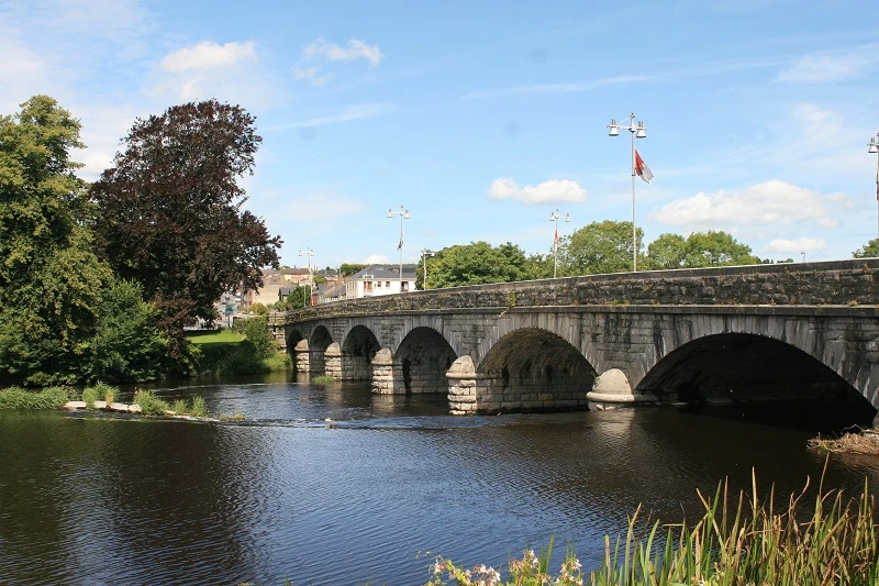
To prevent floods in Ballinasloe, a weir was constructed in 1885 right above the four-arch bridge. It had draw-doors that could be raised when a flood was imminent. It is regarded as one of Ireland’s longest rivers.
River Liffey
Length: 132 km
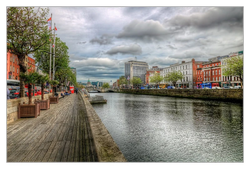
The River Liffey is a river in eastern Ireland that finally flows through Dublin and into Dublin Bay (Irish: An Life, formerly An Ruirthe(a)ch). Among its important tributaries are the River Camac, the River Poddle, and the River Dodder.
The River Liffey, a significant landmark among the rivers in Ireland, supplies much of Dublin’s water and offers a range of recreational options. From the city’s Viking origins to the present, trade has been conducted along its banks in Dublin. It is connected to the River Shannon via the Grand Canal and the Royal Canal.
Although ships used to reach Dublin’s city centre, with significant landing spots up to St James’ Gate, there is currently no significant traffic on the river itself above the East-Link bridge.
The flow of the Liffey is diverted for industrial and drinking purposes by about 60%. Most of this returns to the river after being cleaned up by wastewater treatment facilities.
Contrary to common perception, the facility takes water from the Wicklow Mountains, not the Guinness brewery. It is regarded as one of Ireland’s longest rivers.
River Erne
Length: 129 km
The second-longest river in Ulster is the River Erne (/rn/ AIRN; Irish: Abhainn na hÉirne or An Éirne), which forms part of the boundary between Northern Ireland and the Republic of Ireland.
The Erne flows for 80 miles (129 km) via Lough Gowna, Lough Oughter, and Upper and Lower Lough Erne in County Fermanagh, Northern Ireland, to the sea at Ballyshannon in County Donegal, Republic of Ireland. The Erne originates three miles south of Cavan in County Cavan, Republic of Ireland.
The River Erne, standing out among the picturesque rivers in Ireland, is 120 km long and boasts a variety of fisheries for trout and salmon along its course and its tributaries. Enniskillen is predominantly situated on an island in the river, nestled between Upper and Lower Lough Erne.
It is connected to the River Shannon via the Shannon-Erne Waterway. Belturbet, Knockniny, Carrybridge, Bellanaleck, Enniskillen, and Killadeas are a few locations along the Erne River that provide live-aboard pleasure cruisers.
Along with live aboard boating holidays, sections of the Erne are used for water skiing, bank fishing, trolling, jet skiing, and scuba diving.
Boaters should use caution when navigating Upper Lough Erne’s maze of small islands, according to the Northern Ireland Tourist Board, while the waves in Lower Lough Erne can be of “open-sea dimensions.”
Useful Resources
Tourism Ireland’s Official Website: https://www.tourismireland.com/
Ordnance Survey Ireland (OSi): https://osi.ie/
Waterways Ireland: https://www.waterwaysireland.org/
Conclusion
In conclusion, the rivers in Ireland are not just some of the country’s most stunning natural beauties, but also vital resources for its citizens.
Every river in the area it runs through is important, including the River Shannon, the longest river in Ireland to the River Erne.