In this article, we are covering top 9 spectacular waterfalls near Chattanooga.
Spring is on the way, and in many places that means lots of rain. In Chattanooga, where we receive an astonishing 53 inches of rain per year, this is especially true. From February through April, nearly-constant precipitation turns the trails into sloppy mush and makes many outdoor activities more challenging—or, at least, less pleasant.
We know April showers bring May flowers, but before the world turns green and those spring flowers bloom there is a silver lining to all this rainfall: it’s the best time for waterfall hikes. This time of year, all of the local creeks are flowing nicely, and eastern Tennessee has no shortage of impressive falls.
With so many options, we’ve decided to put together a list of the largest and most spectacular outdoor waterfalls in the area. We’re talking big, tall, powerful waterfalls; everyone falls on this list features at least 50 feet of free-falling water, and some considerably more than that.
List Of Waterfalls Near Chattanooga
Lula Falls
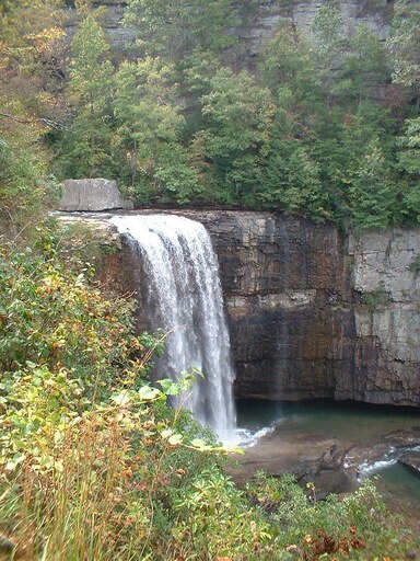
Height: 110 feet
Driving Distance to Trailhead: 12 miles
One of the most magnificent waterfalls in the area is Lula Falls. It is a centerpiece of the Lula Lake Land Trust and one of the nicest in the Chattanooga region. The lower falls are the more popular of the two, however, the higher falls are also great, with a particularly lovely cascade spilling into the lake that gives Lula Lake its name.
This waterfall runs all year long and is especially thundering after a strong winter downpour, with spray frequently drifting up out of the canyon and onto the trail above. The base of the falls is reached through a recently built access trail that has substantial rockwork and stone stairways.
The restoration of this area after years of intensive logging and mining has been a thirty-year endeavor, and its current state is a remarkable conservation success story. At the moment, Lula Lake is only open a few days per month to minimize the effect.
Fall Creek Falls
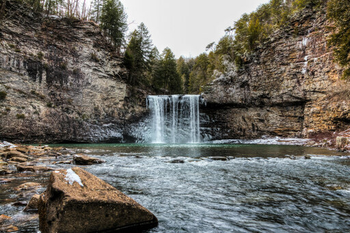
Height: 256 feet
Driving Distance to Trailhead: 72 miles
The 256-foot-tall Fall Creek Falls flow a tremendous volume of water in the spring. It is the tallest free-falling waterfall in the eastern United States, and Coon Creek Falls, at 250 feet tall, is just a little shorter but typically less stunning. The park’s namesake’s year-round flow is guaranteed by Fall Creek Falls Lake.
If we weren’t able to group them here, several additional waterfalls in the park, including Piney Creek Falls (95 feet), Cane Creek Falls (85 feet), and Rockhouse Falls, would be eligible for this list on their own (125 feet). You won’t be let down if you visit after a significant downpour and bring your camera.
Greeter Falls
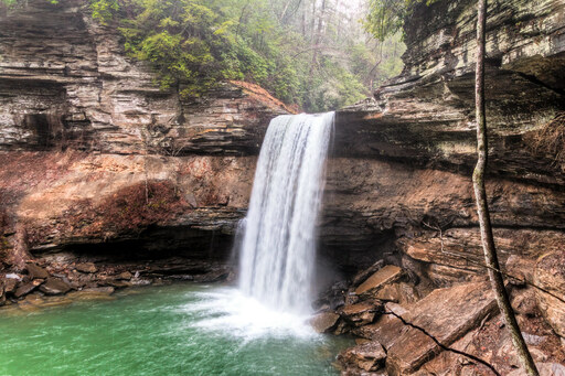
Height: 50 feet
Driving Distance to Trailhead: 59 miles
Three waterfalls may be found on this quick trip around Savage Gulf, including Greeter Falls. The Greeter Falls Loop Trail at Savage Gulf (part of South Cumberland State Park) is one of the best waterfall hikes in the area, perhaps the best. This quick circle route leads to Upper Greeter Falls, Lower Greeter Falls, and Boardtree Falls in a state park that is dripping with waterfalls.
You must descend a sometimes-slippery wooden ramp to reach the brink of a lovely pool at the base of a significant waterfall after dropping into a gorge that is so steep that the trail includes a spiral staircase. You can’t beat the view at this swimming hole, which is among the nicest in the area.
While you are here, it is worthwhile to make the quick detour to Upper Greeter Falls, and Boardtree Falls is good enough to warrant making the short circle hike rather than returning the way you came. With its stunning bluff lines and rugged, undulating terrain, this hike is a great example of Cumberland Plateau trekking.
Falling Water Falls
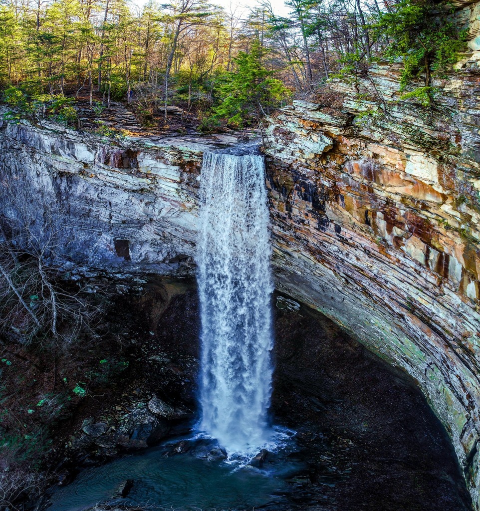
Image Credit: https://www.facebook.com/pages/Falling%20Water%20Falls%20State%20Natural%20Area/1869225529793202
Height: 110 feet
Driving Distance to Trailhead: 12 miles
Falling Water Falls State Natural Area is a small plot of land with an even smaller parking lot, a single trailhead, and a short route ascending to the top of a very large waterfall.
Falling Water, like numerous other waterfalls on this list, cascades from a sandstone shelf at the edge of the Cumberland Plateau and plunges straight down into a steep valley below. It can be reached from the bottom if you want to get a better shot, but there is no trail and the terrain is exceedingly rocky. At spring water levels, the spray, as with Laurel Falls below, makes photographing difficult.
Because Falling Flood Creek does not drain a huge area, it can flash swiftly during periods of heavy rain, and the water levels often recede just as quickly. The soil along the edge of this very exposed cliff face is slanted, slippery, and treacherous, so tread carefully.
Laurel Falls
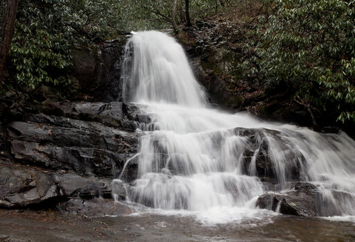
Height: 80 feet
Driving Distance to Trailhead: 40 miles
The Laurel-Snow State Natural Area on the Cumberland Path in Dayton, Tennessee is one of the most scenic parts of the trail at the southern end of the Cumberland Plateau near Chattanooga. The majestic Laurel Falls, at the end of a 2.4-mile spur trail with 900 feet of elevation increase, is unquestionably its centerpiece.
Following the lovely Richland Creek at first, the trail gradually ascends a hillside to cross Laurel Creek. Once you’ve made it across, the track becomes really difficult, winding among and around huge boulders and dozens of waterfall cascades. A trailside pool provides a lovely place to relax. When you reach the top of the creek’s steepest section, you will see Laurel Falls falling from the cliff above.
Ozone Falls
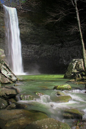
Height: 110 feet
Driving Distance to Trailhead: 72 miles
One of the nicest swimming spots you can locate on a hot summer day is Ozone Falls. The Ozone Falls State Natural Area is home to Ozone Falls, which plunges 110 feet into a commanding valley. Like Falling Water Falls, Ozone Falls has its own SNA. There is a trail that leads to both the top and bottom of the falls along the Cumberland Trail’s Crab Orchard Mountain section.
Another favorite swimming area is the pool below the falls. The combination of the height of this waterfall, it’s straight landing in a pool, and the shape of its natural amphitheater keeps the air filled with mist, which is a beautiful feature on hot summer days.
While the creek that feeds Ozone Falls is called Fall Creek, it is unrelated to the source of Fall Creek Falls, which is located some distance away. This waterfall is the furthest away from downtown Chattanooga of those on this list, but its proximity to I-40 makes it ideal for a day trip. Despite this, it is one of the region’s lesser-known falls taller than 100 feet.
Foster Falls
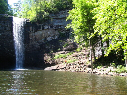
Height: 60 feet
Driving Distance to Trailhead: 36 miles
Foster Falls is a well-known attraction in the Chattanooga area. Foster Falls is a name that everyone has heard of. This is due in part to the fact that it is a significant sport climbing destination in the Southeast (with approximately 200 sport climbing routes), in part to its location along the deservedly famed Fiery Gizzard Trail, and in part to it simply being one of the nicest waterfalls around Chattanooga.
Make it a point to visit this one if you haven’t already. The Foster Falls Small Wild Area offers seasonal camping as well as trail access to the bottom of the falls and various vistas. The entire area below the falls is stunning, and a short hike combining the climber’s loop at creekside with the Fiery Gizzard Trail atop the cliffs is a fantastic way to work up a sweat before swimming in the pool below the falls.
The waterfall is one of the best in the area, making it one of the most renowned recreational sites within striking distance of Chattanooga. Beauty is in the eye of the beholder, and while there are prettier places on our list, the environment here is unrivaled. Of course, this means it’s a popular spot, so be prepared for a throng.
DeSoto Falls
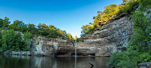
Height: 80 feet
Driving Distance to Trailhead: 51 miles
Even though DeSoto State Park is a little distance from Chattanooga, the short travel to the Mentone/Fort Payne region is worthwhile for DeSoto Falls alone. To get the most out of your visit, combine it with a trip to Little River Canyon to see the very nice Little River Falls or spend some time exploring the rest of the state park.
One of the more convenient options, a short concrete path goes to an overlook next to this magnificent waterfall from a tiny parking area. At the very top, water overflows a concrete dam, cascades down a wide, magnificent cascade, and finally plunges 80 feet down a ledge into a plunge pool the size of a small lake.
The park also has trails worth exploring, as well as several lovely (albeit smaller) waterfalls. Within the park, there are over 25 miles of trails, 11 of which are accessible to mountain bikers.
Hemlock Falls / Cherokee Falls
Height: 90 feet / 60 feet
Driving Distance to Trailhead: 28 miles
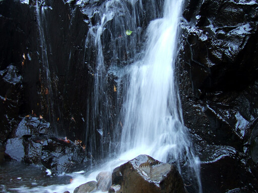
Hemlock Falls is one of Cloudland Canyon State Park’s two major waterfalls. The two beautiful waterfalls along Daniel Creek at Cloudland Canyon State Park are officially named Hemlock Falls. It’s only a short journey from the main parking lot at the gorge’s edge to both of them, but it’s a steep one—like, six hundred stairs steep.
These waterfalls are both well worth the climb, and the Sitton’s Gulch Trail, which begins at the bridge across Daniel’s Creek and follows the river down the canyon, is equally beautiful. Cloudland Canyon is just a few minutes drive from the core property of the Lula Lake Land Trust, so you can visit both in a single day, and you can hike from one to the other along the Cloudland Canyon Connector Trail.
Cherokee Falls is the more scenic of the two, featuring a wonderful grove of trees at the side of its plunge pool. The spur route to the colossal Hemlock Falls stops at an observation platform with a spectacular view but no actual access to the waterfall’s base. It’s easily identified by the enormous boulder sitting squarely between the platform and the falls.
